
Each Ogallala state’s groundwater administration has developed on a slightly different timeline and with slightly different objectives. While scientific understanding of the connectivity of surface and groundwater systems lagged in relation to development of the resource, in general, the aquifer has been managed in most areas with an understanding that it is a limited resource. Water conservation efforts vary locally and on a state-by-state basis. As water levels decline, withdrawals from the aquifer will also decline as physical availability and economics dictate.
The following timeline of the aquifer’s development describes how we arrived at the current system of management and administration.
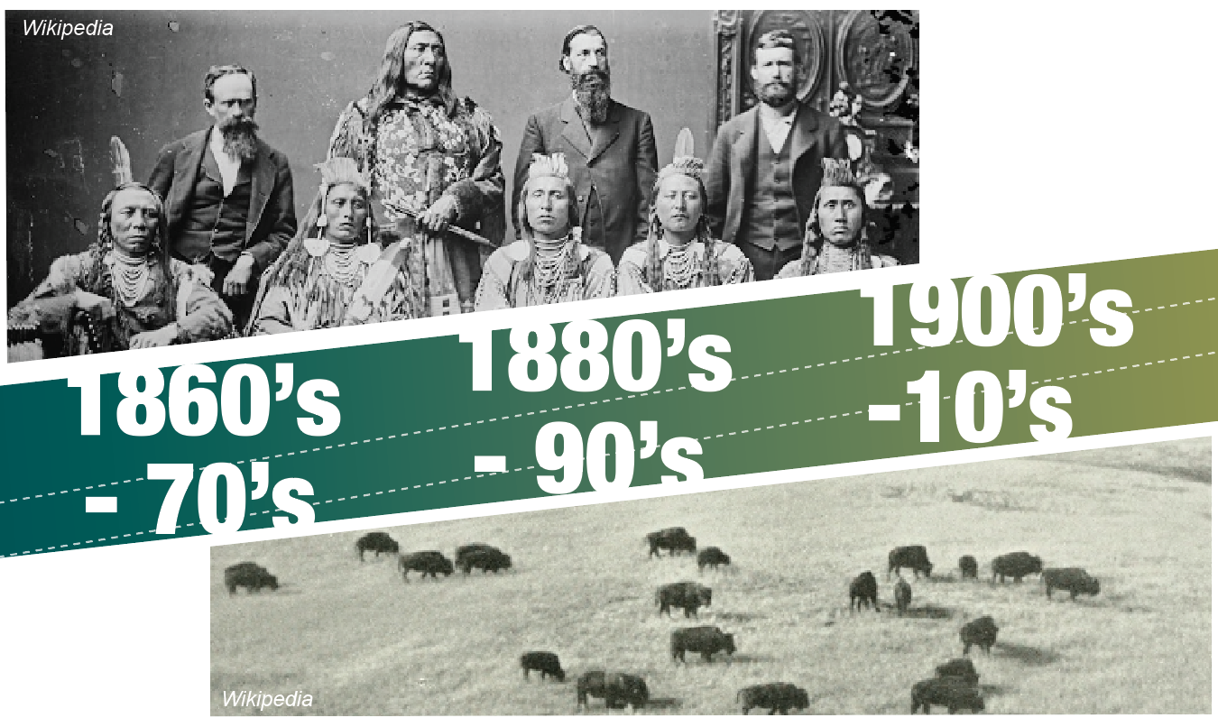
1860s-1870 – Westward railroad extensions across the High Plains encouraged settlement and agriculture
1862 – The Homestead Act began the homesteading period across the High Plains
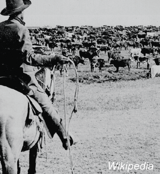
1866 – Post-Civil War cattle drives from TX to railroad terminals in KS
1868 – Kansas legislature established common law statutes for water
1874 – Introduction of barbed wire, allowing farmers to fence livestock out of crop fields
1880 – NE scientist Samuel Aughley promoted the theory that “rains follow the plow”
1890 – New version of steam-powered centrifugal pump adopted around Garden City, KS. Improved versions using gasoline engines were in mass production by late 1930’s
Water from springs at the head of Whitetail Creek, Keith County, Nebraska. The water issues from the upper part of the Broadwater Formation (Pliocene) just below the contact with the sands of the Nebraska Sand Hills, all parts of the High Plains Aquifer in Nebraska. Image courtesy of R.F. Diffendal, Jr., University of Nebraska.
1898 – Ogallala Aquifer named by geologist N.H. Darton after the formation outcrop near the town of Ogallala, NE
1909 – First high-capacity irrigation well on the High Plains was drilled in Bailey County, TX
1910 – Centrifugal pump technology expands
1917 – WWI demand for wheat encourages sod busting for cultivation
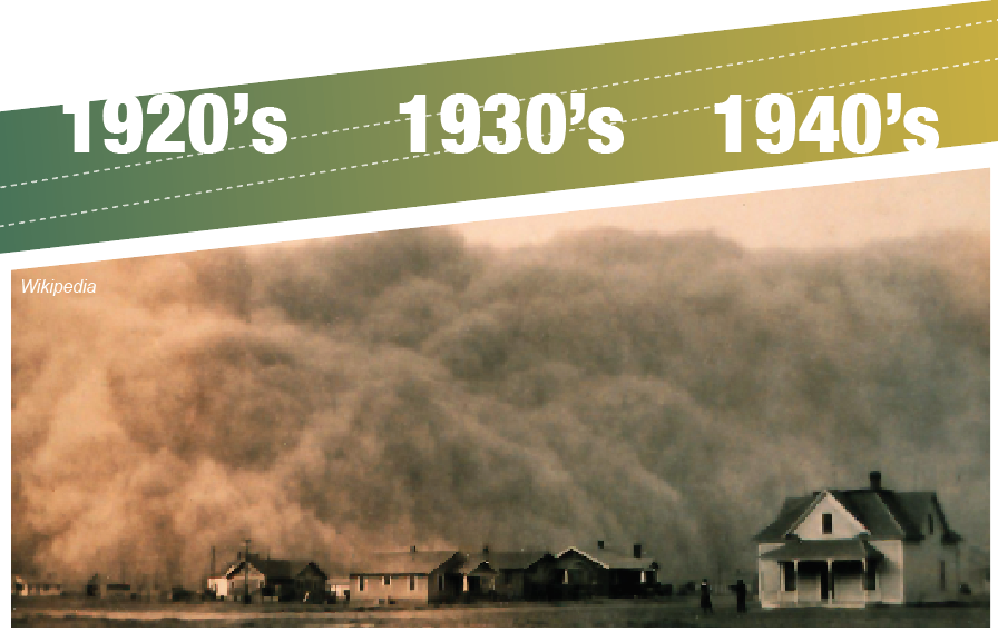
1920’s – Favorable precipitation patterns during this decade encouraged further cultivation and limited well development
1927 – New Mexico, last of Ogallala states admitted to Union in 1912, was first to enact groundwater legislation in 1927. KS followed in 1945
1930’s – Standard and reverse rotary drilling methods replaced cable-tool methods
1930 – Onset of a decade of drought led to a period of rapid well development in the TX Panhandle
1932 – The Soil Conservation Service was established in 1932 to address Dust Bowl concerns; SCS moved from the Interior Department to USDA in 1935
1933 – Fred Hoeme, an Oklahoma farmer, develops the chisel plow, helping curb wind erosion
1936 – Congress established Rural Electrification Administration (REA) leading to electrification across the High Plains during the 1940’s
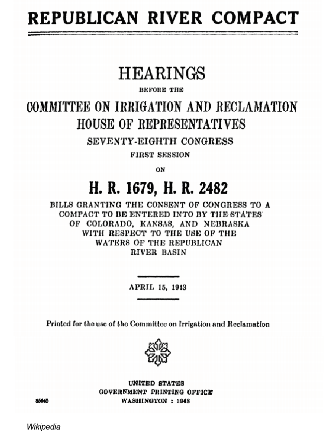
1943 – Republican River Compact negotiated between NE, KS, and CO to share the river’s waters, fed in part by groundwater
1945 – Kansas legislature passed the “Kansas Water Appropriation Act”
1949 – First statutory law to regulate groundwater in Oklahoma was adopted imposing appropriation doctrine

1951 – The High Plains Underground Water Conservation District No.1 (TX’s first groundwater conservation district) is established
1952 – Frank Zybach, a Nebraskan farming east of Denver, invented the center pivot
1954-1957 – Severe drought began another period of intense well drilling that lasted into the 1960’s across the region
1957 – CO passes the 1957 Ground Water Law, requiring permits for new wells and establishing the Colorado Groundwater Commission, invested with the authority to identify critical ground water areas that “have approached, reached or exceeded the normal annual rate of replenishment
1957 – Kansas legislature made significant amendments to the Kansas Water Appropriations Act
1960s – 170,000 irrigation wells were irrigating over 13 million acres from the High Plains Aquifer across the 8 states. 40% of US feedlot beef cattle were being fattened on the 6 principal Ogallala states
1962 – NM Interstate Stream Commission completed construction of Ute Dam and Reservoir.
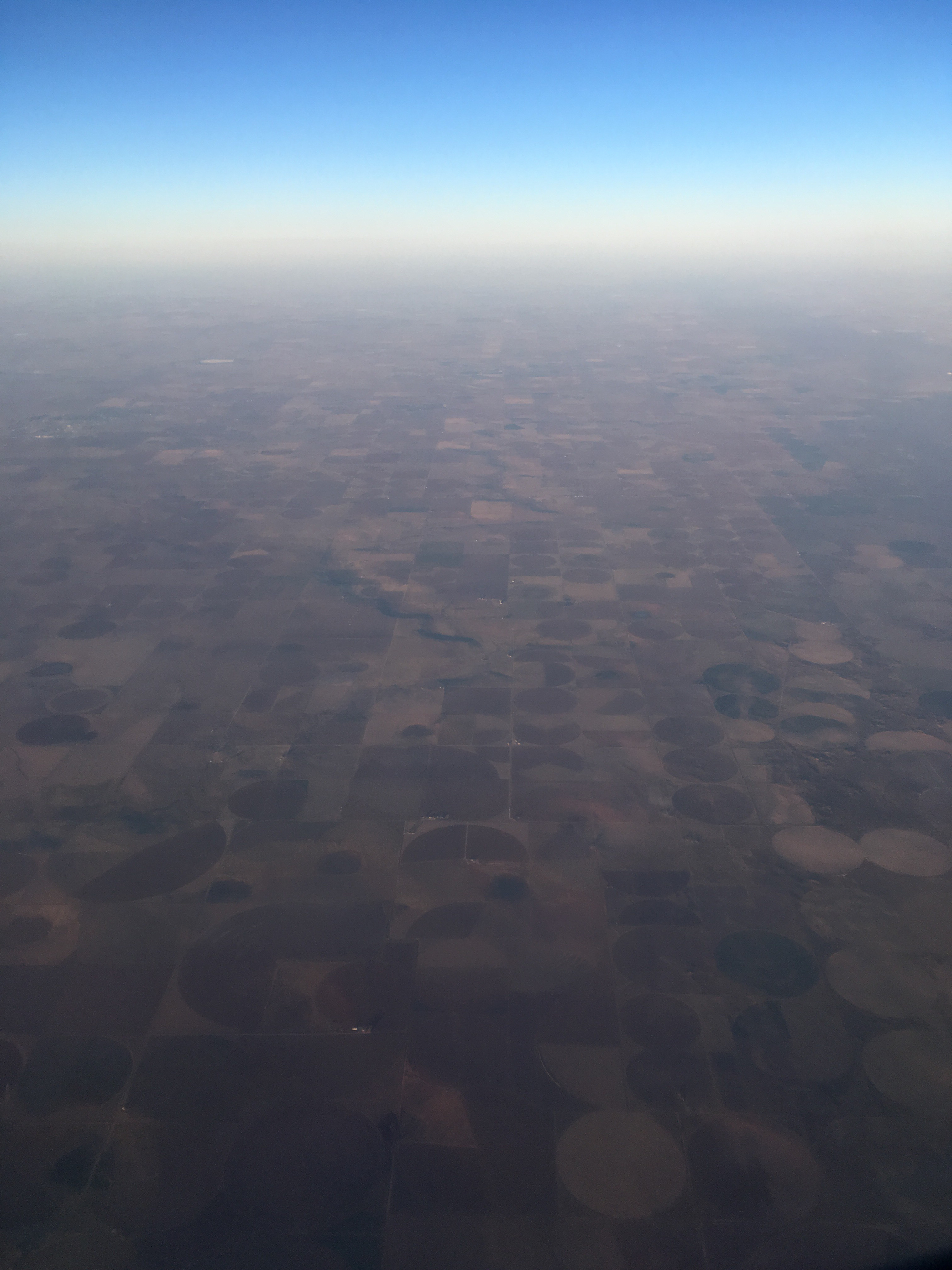
Aerial view of pivot circles in the Texas Panhandle. Winter, 2018. Photo: A. Kremen
1967-1977 – Irrigators in CO and KS create irrigation management districts on the High Plains to protect the interests of irrigators
1972 – NE is divided into Natural Resource Districts, creating a localized level of government tasked with preserving groundwater resources
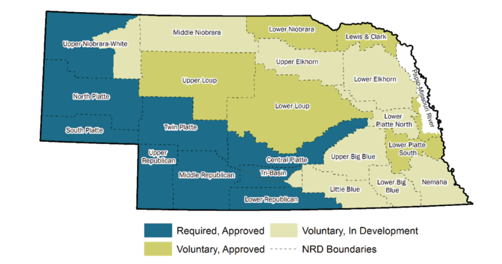
Current status of integrated management plans in Nebraska’s Natural Resource Districts (2018).
Image courtesy of NE DNR.
1977 – Peak number of acres irrigated reached in the High Plains region. Irrigation has decreased slightly in some areas as water levels have declined
1972 – Kansas Groundwater Management District Act
1973 – Oklahoma’s 1949 groundwater law replaced with allocation system
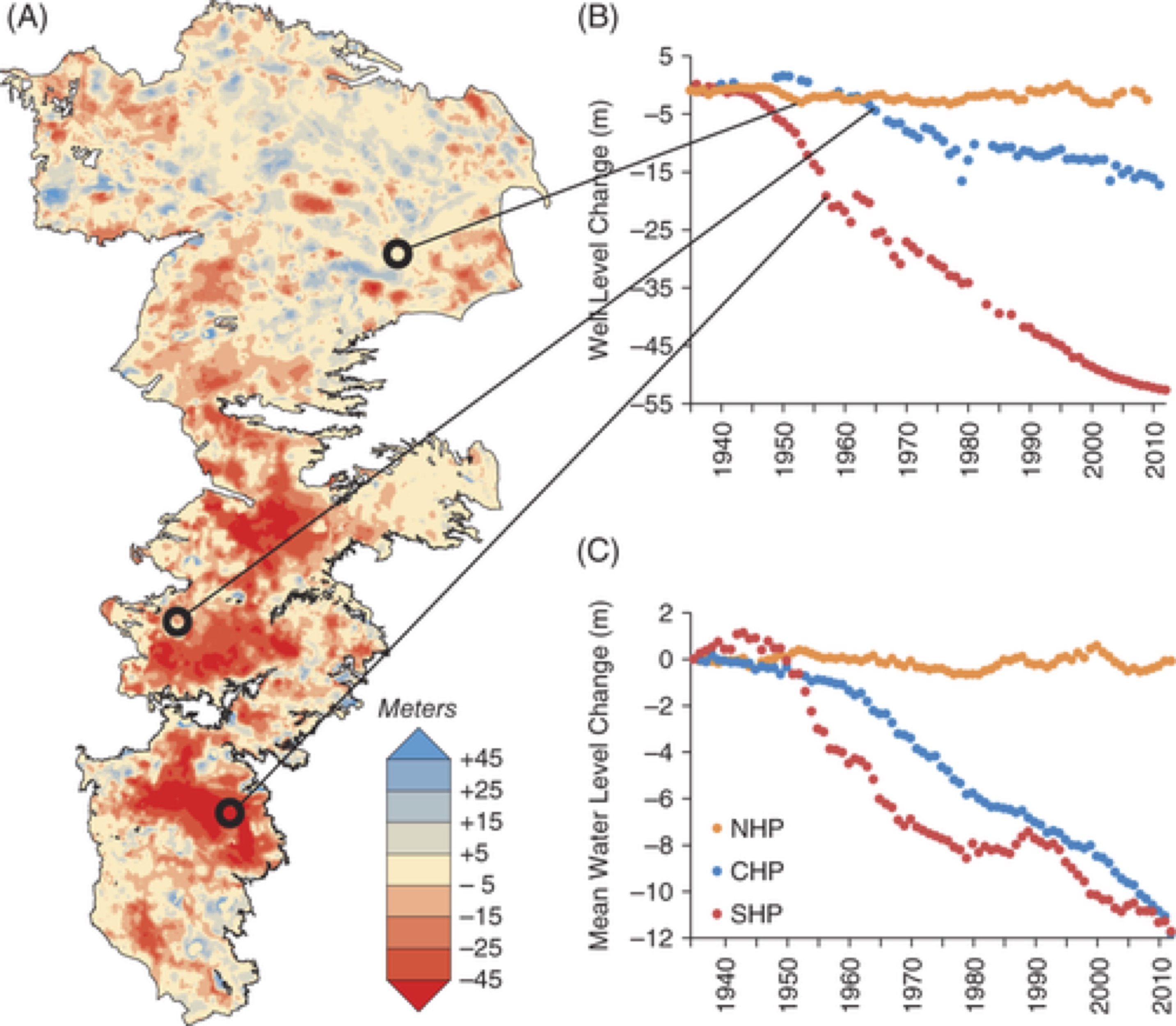
E. Haacker et al. (2015). Water Level Declines in the High Plains Aquifer: Predevelopment to Resource Senescence 54 (2): 231-242. DOI: 10.1111/gwat.12350

1980s – Low energy precision application (LEPA) systems developed by Dr. Bill Lyle with the Texas A&M Research and Extension Center at Lubbock, Texas
2005 – United States adopts first Renewable Fuel Standard, requiring the use of biofuels and driving the price of corn to record highs
2009 – Congress authorized major Federal funding for the Ute Pipeline Project, officially known as the Eastern New Mexico Rural Water System (ENMRWS), in the Omnibus Public Land Management Act. This milestone was ~45 years in the making
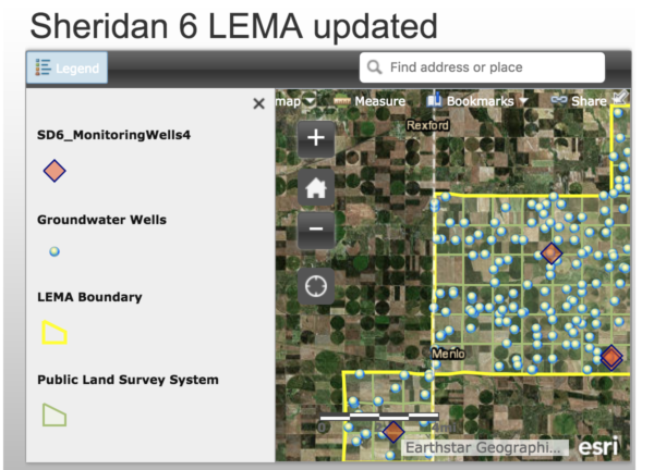
2013 – Kansas farmers set up a 10-square-mile conservation zone called the Sheridan-6 Local Enhanced Management Area
(LEMA), where farmers agreed to a 20 percent reduction in irrigation for five years.
Screenshot, right: For a wide range of updated, detailed information about this LEMA including interactive maps, well data, and more, visit the Kansas Geological Survey website.
2017 – USGS reported on water level declines across the Ogallala region from pre-development (~1950) to 2015. Area-weighted, average changes for the period of 2013-2015 were estimated to be 1.2 inches of decline in New Mexico, 2.4 inches of decline in Colorado, 14.4 inches of decline in Kansas, 15.6 inches of decline in Oklahoma, 18 inches of decline in Texas, and no decline in northern states of Nebraska, South Dakota, and Wyoming.
2017-2018 – Southern High Plains region entered a period of persistent drought beginning in the fall of 2017, seriously impacting winter wheat and other crops including spring plantings.
2018 – The Sheridan-6 LEMA (see 2013) was re-instituted for a second 5-year period, and a separate, “district-wide” LEMA was designated in Northwest Kansas’ groundwater management district (GMD) 4.
2018 – In April, 200+ water management leaders from all 8 Ogallala states attended the Ogallala Aquifer Summit in Garden City, Kansas. Over 2 days, the group shared their expertise and perspectives on effective management practices and support systems (local, state and Federal policies, incentive and educational programs, markets, etc.) with potential to conserve water and sustain agricultural productivity in the Ogallala region.
This information was adapted (from material written by the Ogallala Water team and design elements created by Emily Pantoja/Colorado Water Institute) initially published in the Nov/Dec 2017 Ogallala aquifer focused issue of Colorado Water.